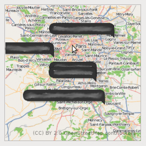
I recently discovered two interesting Gnome projects: libchamplain and Geoclue. Libchamplain is a library to create and handle maps. Geoclue is a set of D-Bus services for positioning. As I wanted to try them, I started to write a small Evolution plugin showing a map with the positions of the contacts contained in an address book.
The principle is really simple:
- Get the contacts with an address defined
- For all of them transform the address into latitude and longitude coordinates using Geoclue
- Create the maps with the markers at the right place using libchamplain
I only have a screenshot to show today as I still haven't published the sources yet. Don't worry I'll update this post as soon as I'll have them somewhere on the web.
I would like to say a big thank you to Pierre-Luc Beaudoin, the main libchamplain developer for having taken some time to help me review my code and find why my markers weren't appearing... (I simply have inverted lattitude and longitude at some point)
Contacts map from Evolution
This gave me some interesting idea for OpenOffice.org: why not having a SmartTag showing a map for an address in Writer?
